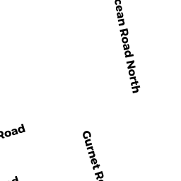
0 GURNET RD
Owner Information
CARVER JOHN & NANCY TT
101 ELY ROAD
MONSON, MA 01057


Property Details
0 GURNET RD is classified as a Undevelopable Residential Land (Vacant land).
0 GURNET RD is valued at $50,500. The land is valued at $50,500 and the structures are valued at $0.
This property is in Zone WP. Confirm with local Zoning Board authorities to ensure there are no overlays or other easements on this property.
The most recent deed for 0 GURNET RD is recorded at the local registrar in Book 19471, Page 0340. 0 GURNET RD was last sold on Thursday, March 8, 2001 for $100.
Assessment data from fiscal year 2021.
Flood Data
This property is partially within the AE Zone (within floodplain). Approximately 15.65 acres (100.0%) of the property is within this zone.
The base flood elevation for this flood zone is 11 feet.
This information is sourced from the FEMA National Flood Hazard Layer. See our full disclamer.
Broadband Internet Providers
| Provider | Type | Bandwidth (mbps) | |
|---|---|---|---|
| HughesNet | Satellite | 25 | 3 |
| Viasat Inc | Satellite | 100 | 3 |
| Verizon New England Inc. | DSL | 5 | 0 |
| Verizon New England Inc. | Fiber | 940 | 880 |
| Comcast | Cable | 1000 | 35 |
| T-Mobile | Fixed Wireless | 25 | 3 |
| GCI Communication Corp. | Satellite | 0 | 0 |
| VSAT Systems, LLC. | Satellite | 2 | 1 |
Broadband service provider data from December 2020.
Adjacent Properties
- 166 GURNET RD
Vacant, Conservation (Municipal or County) owned by DUXBURY TOWN OF - 0 GURNET RD
Vacant, Conservation (Municipal or County) owned by DUXBURY TOWN OF - 0 GURNET RD
Vacant, Conservation (Municipal or County) owned by DUXBURY TOWN OF - 0 GURNET RD
Vacant, Conservation (Municipal or County) owned by DUXBURY TOWN OF